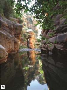
The new maps of the Verde River system will aid water managers, wildlife biologists, ranchers, and archeologists in study of our water supply and riparian habitats. They will also help in the adjudication of water rights.
In the Verde Valley, lake and related alluvial fan deposits accumulated until about 2.5 million years ago, prior to the development of the river. After that time, water flowing off the Mogollon rim began cutting what became deeply incised canyons in the sediments and eventually into bedrock.
The mapping also records evidence of long human habitation in the developing river system from the Clovis Culture 11,500 years ago through several American Indian cultures up to about 1400 AD.
The report and specific maps may be downloaded free from: http://repository.azgs.az.gov/uri_gin/azgs/dlio/780
Other interesting reports can be found at the AZGS Document Repository at:
http://repository.azgs.az.gov/
For even more information visit AZGS online publications page where a variety of maps and reports may be downloaded free: http://azgs.az.gov/publications_online.shtml
AZGS press release:
The Arizona Geological Survey (AZGS) just released ten new geologic map sheets showing the extent and age relationships of Holocene channel and floodplain deposits along tributaries of Verde River of north-central Arizona. A 43-page report accompanies the maps.
Arizona’s rivers are an integral part of the State’s water resources. In an ongoing effort to understand these resources, the Arizona Department of Water Resources engaged AZGS to map Holocene-age deposits of the Verde River as part of the Gila River stream adjudication program.
This work comprises over 370 miles of new and updated maps of the surficial geology of Verde River tributaries, including: Oak Creek, Wet Beaver Creek, West Clear Creek, Fossil Creek and the East Verde River.
AZGS’s mapping team constructed geologic strip maps of a two-mile wide swath centered on the river’s active channel and running the length of the river. Geologic mapping was overlain on USGS 7.5 minute, 1:24,000-scale topographic maps. The team used earlier mapping, aerial photography, and extensive field work – establishing GPS stations on approximately one-mile centers along the course of the river – to map modern and recently active channel and floodplain deposits, river terraces and adjacent tributary deposits, eroded older basin deposits, and bedrock.
The geologic maps provide foundational geologic data for deciphering the recent history of major tributaries of the Verde River watershed. Young Verde River sediments – those deposited over the past 10,000-years — are subdivided by age and broadly grouped into two classes: channel deposits that comprise mostly sand and gravel; and, overbank floodplain and terrace deposits that consist of sand, silt, and clay with minor gravel.
Stakeholders – water managers, civil authorities, ranchers, wildlife biologists, archeologists, environmentalists, and the Arizona public – should find these maps indispensable for physical and biological studies of the riparian corridor of these tributaries.
Printed copies and the GIS data are available at the AZGS Map & Book Store at 416 W. Congress, Ste 100, Tucson, 85701. To order call 520-770-3500 or fax 520-770-3505.
Citation: Cook, J.P., Pearthree, P.A., Onken, J.A. and Bigio, E.R., 2010,
Mapping of Holocene River Alluvium along Oak Creek, Wet Beaver Creek, West
Clear Creek, Fossil Creek, and the East Verde River, Central Arizona.
Arizona Geological Survey Digital Map DM-RM-3, 43 p., 10 map sheets, scale
1:24,000.
NOTE: The Verde River tributaries report and maps are also available at
the Arizona Department of Water Resources Mapping of Holocene River
Alluvium along the Verde River, Central Arizona, as Phase II Summary Report
and Phase II Geology Maps.
http://www.azwater.gov/AzDWR/SurfaceWater/Adjudications/default.htm
